Geophysics

With apologies for the colour scheme (I'm so sorry if you're colour blind!). This is the lower layer of a two layer 1D inversion model, interpolated. Was playing with maximizing the contrast to try to find the foundation of the Richardson Mansion that existed on this property prior to it being bulldozed in the 70s and donated to the City of Winnipeg to become Munson Park. I'm pretty sure I captured it in the red square in the middle.

This is my EM34-3XL. Have you ever used one? What was your target? How many years/decades ago was it? ;)

 www.youtube.com
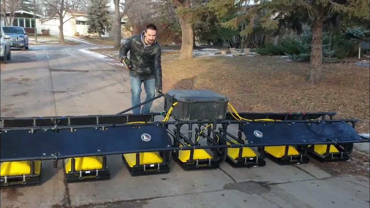
Shameless OC. This is my video of a test I did for an R&D project -- the custom cart and GPR rig.


> "The Earth's magnetic field is primarily generated by currents in the liquid outer core, though some geophysicists argue that an unexplained mismatch with models suggests that the Kinder toy contains a magnet."
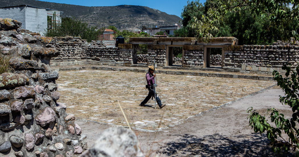
Tl;dr: Pine Creek, MB investigates GPR anomalies at residential school, finding interesting things but no bodies so far.

Biting my tongue.... "about six inches"
 www.youtube.com
I make little tutorial vidoes for my rental customers. Maybe it's useful to someone :)

This literally used to be my job -- so please ask if you have questions.

If anyone has any geophysical cable horror stories, fire away! > The ideal mix for maximum competitive cable-coiling energy is one A/V tech, one rock climber, one sailor, and one topologist. https://xkcd.com/2810/


 www.youtube.com
One of my ABEM rental customers said they were using this and quite liked it! Anyone used it before?

It's not geophysics unless it runs on batteries and has wires sticking out...
The geophysicist replied without lifting their head up: “Noises? No problem. I got tons of filters here. What’s the frequency?”

Site was being scrubbed from the planet when I was last there -- might not exist at all now.

"The USGS operates a really neat email/SMS earthquake notification service (earthquake.usgs.gov/ens/) that allows fine-grained control of notifications."
 www.nature.com
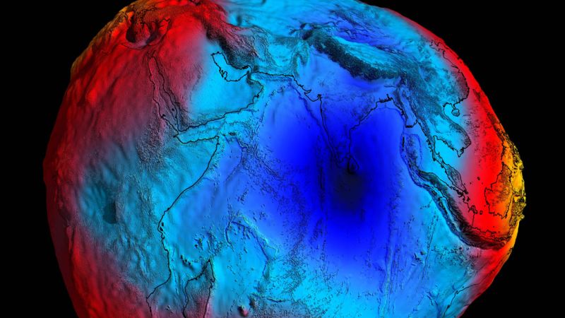
Not alarmist, just cool. When I was in grad school we studied we used dInSAR to study groundwater pumping related subsidence. It makes perfect sense that there would be mass redistribution.

 link.springer.com
This thesis just won a major prize from the Royal Astronomical Society. https://ras.ac.uk/news-and-press/news/2022-thesis-prize-winners-announced

Abstract > In the absence of surface indications of burial sites, law enforcement or humanitarian organizations are faced with the difficult task of focusing large-scale ground searches to a manageable excavation area. A geoforensic-based survey may exclude parts of the landscape for reasons such as diggability or viewshed analysis but leave areas still too large for invasive exploration. This work examines how drone-based remote sensing, geophysics, and search dogs may be combined to narrow such searches. Here, we ask the reader to consider two examples where forensic geomorphology and land use provided a range of possible burial locations. Following this is a multi-proxy approach to similar dilemma, with a search-to-scene case study using remote sensing (drone photography), geophysics, ground probes, and search dogs. This approach is not presented as a definitive guide, but serves as an example of the conjunctive use of well-studied methods to approach a common problem in geoforensics.

From my time with Aurora Geosciences. Pole-dipole, GDD tx and Iris rx. It was a good day when you were on transmitter duty. Keep everything running, and read the Kindle. :)
Geophysics
!geophysics@lemmy.caGeophysics community, not restricted to Canada.
General rules: must be geophysics related or adjacent (this is a very wide scope, and includes things like stellar earthquakes); must adhere to lemmy.ca moderation rules; no pseudoscience.
See also !geology@lemmy.ca